
Climate change is not something we directly see or touch. Rather, to understand how the climate is changing, we rely on mediating tools: maps of sea level rise projections, or models of changing atmospheric patterns. These ways of seeing a landscape shape approaches to climate change adaptation. Planning for large-scale regions like deltas too requires what Latour calls “immutable mobiles” - representational tools that help experts understand and act on a delta. These representations are technical, but they are also political, privileging one view of the world over others. Take the hydraulic model, which envisions rivers as linear channels of flow, devoid of ecology and society. These conventional ways of depicting risk and adaptation at the regional scale tend to see deltas through a narrow disciplinary scope: a river becomes a model.
In this research studio, we analyze how environmental change is represented in our site and develop new representational tools for thinking across large spatial scales and intervening in complex systems. Just as architects make drawings rather than buildings, planners make maps rather than regions. Interrogating the representations that plans rely upon is one way to design more critically with a damaged planet.
The curriculum is split into four parts: (1) analyzing existing representations, (2) critiquing how these representations have transformed our site, (3) re-presenting our site based on these critiques, and (4) proposing an intervention.
Part 4: Intervention - Democratizing Infrastructure
As a native New Orleanian, I was stunned by how little I understood or noticed about the city’s flood infrastructure before beginning this research. I realized that this disconnect between individuals and infrastructure is integral to the problem.
Perhaps if we spatially connect New Orleanians to the infrastructure around them, we could encourage inhabitants to understand how the system functions and intervene in a more effective way. In turn, by transforming flood infrastructure into a multi-functional space, infrastructure could foster positive social, environmental, and economic results. This project aims to create a mutually-beneficial relationship: by designing infrastructure that serves inhabitants beyond its typical scope, perhaps inhabitants might better support infrastructure.
There are 24 pump stations in Orleans Parish that are responsible for pumping water vertically out of the city’s bowl-like shape. While the shape, size, and location of these stations vary drastically, they all pose an opportunity for the inclusion of a social program in addition to its traditional function.

DPS 10

DPS 2

DPS 4
In my proposal, I imagine Drainage Pump Station (DPS) 10 as a Katrina Memorial Museum and community center. DPS 4 is transformed into a neighborhood park and garden that bridges two communities together. DPS 2 becomes a Volunteer Center along the Lafitte Greenway that houses a new Catch Basin Klean-Up Krewe. In each case, New Orleanians are invited to occupy a previously unseen landscape and encouraged to learn about flood infrastructure and water management in New Orleans.
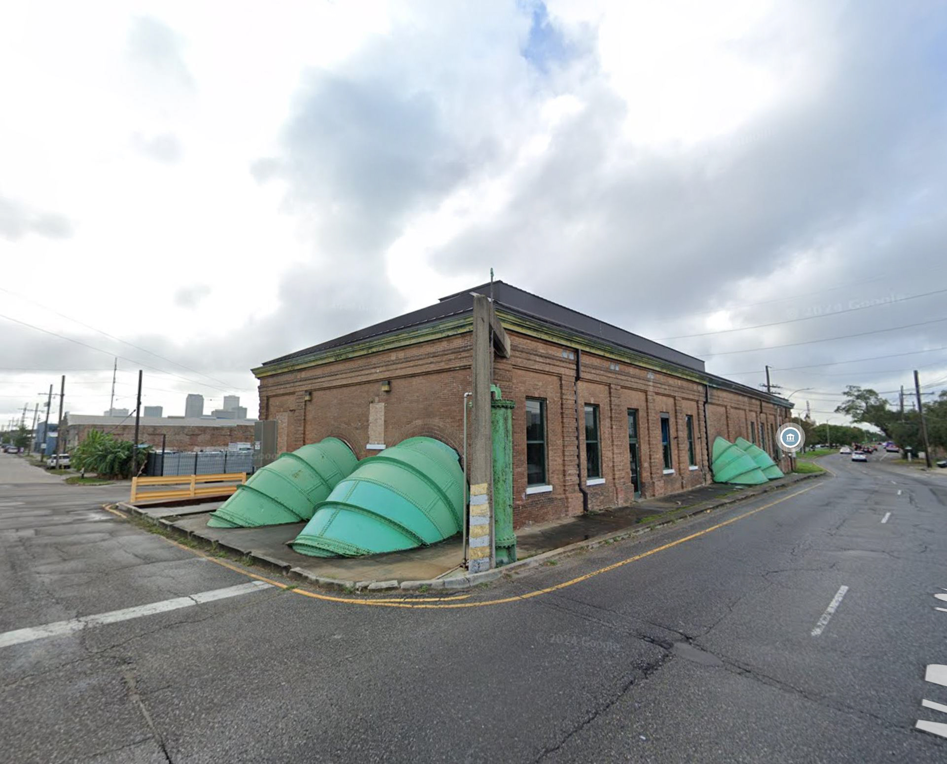
DPS 10: Katrina Memorial Museum
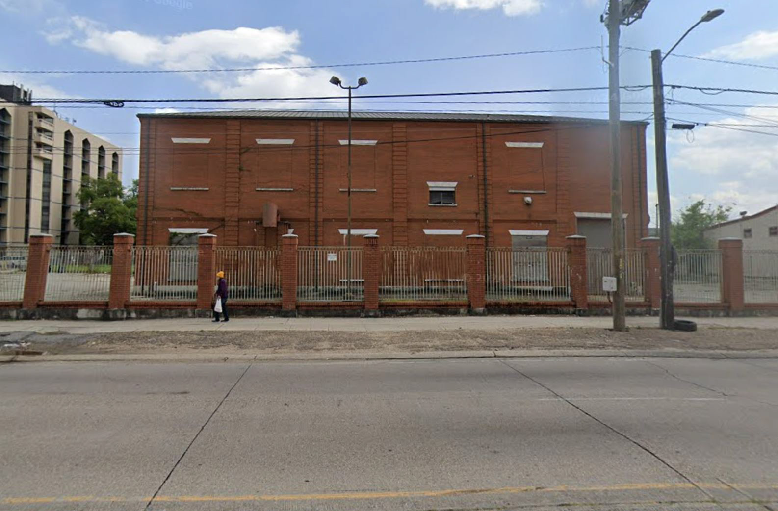
DPS 10: Existing Conditions
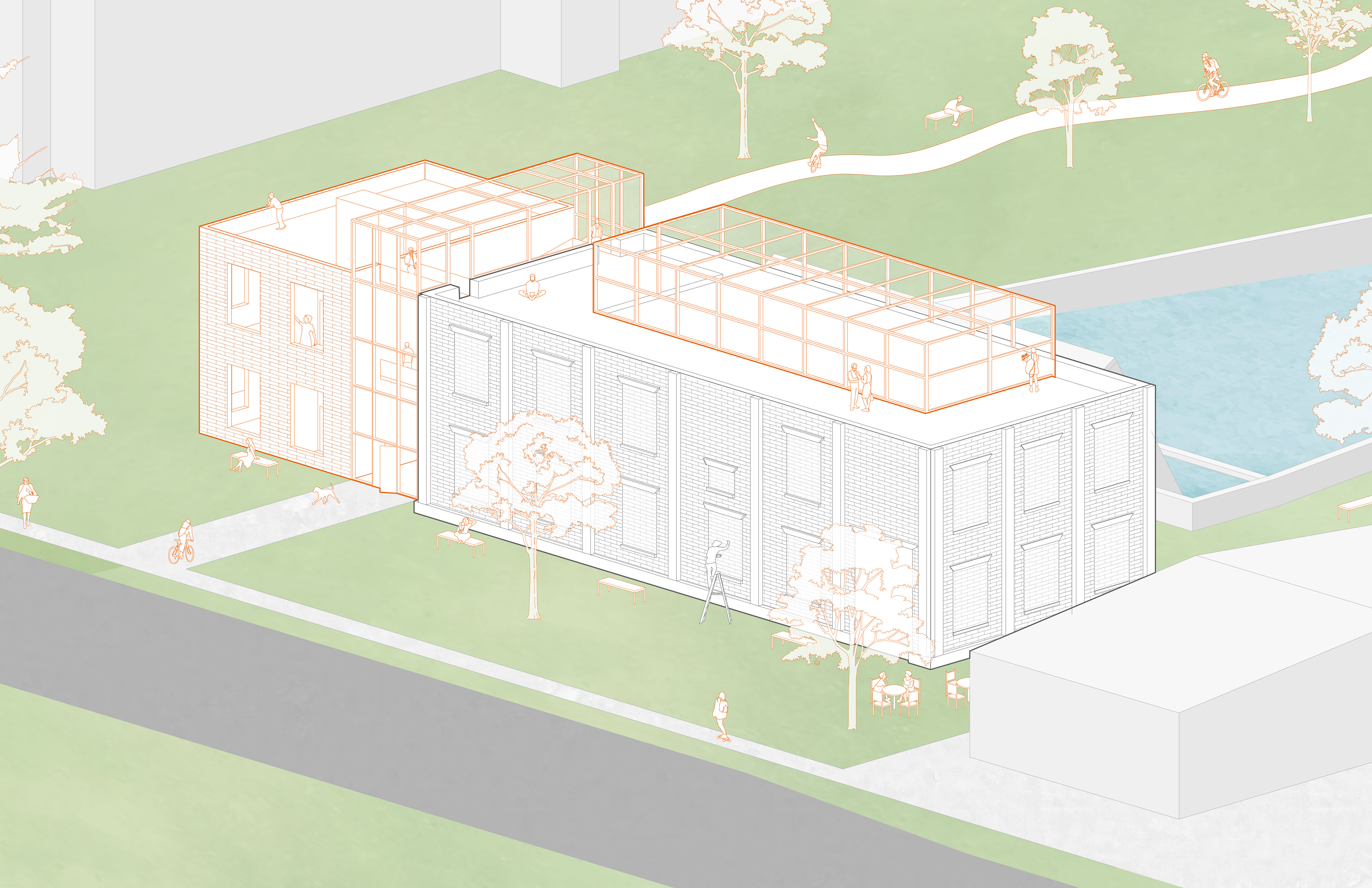
DPS 10: Site Axonometric
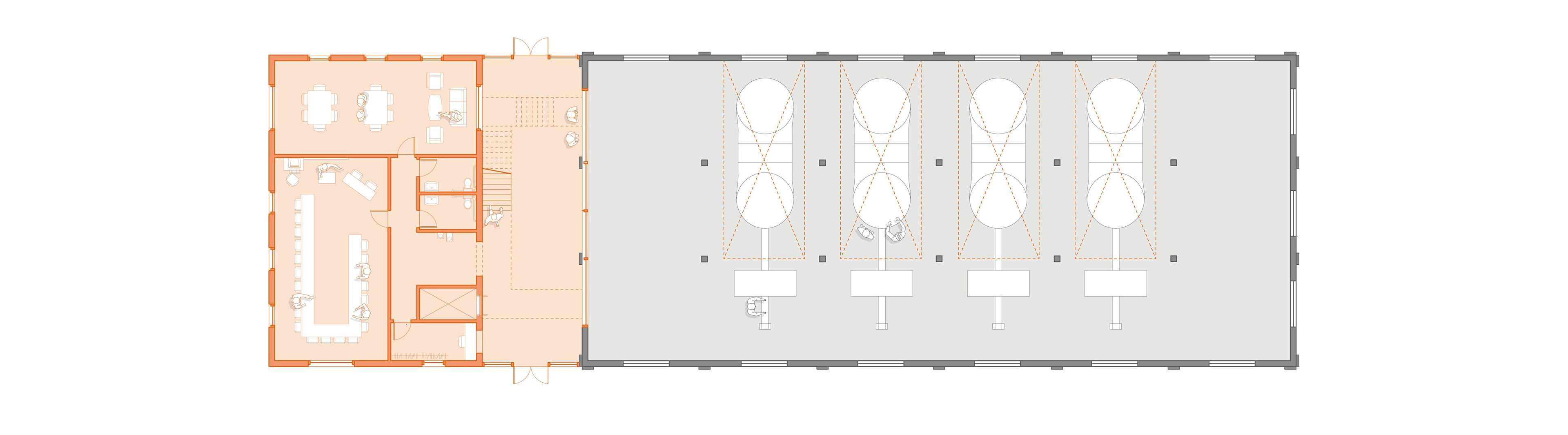
DPS 10: Level 1

DPS 10: Level 2
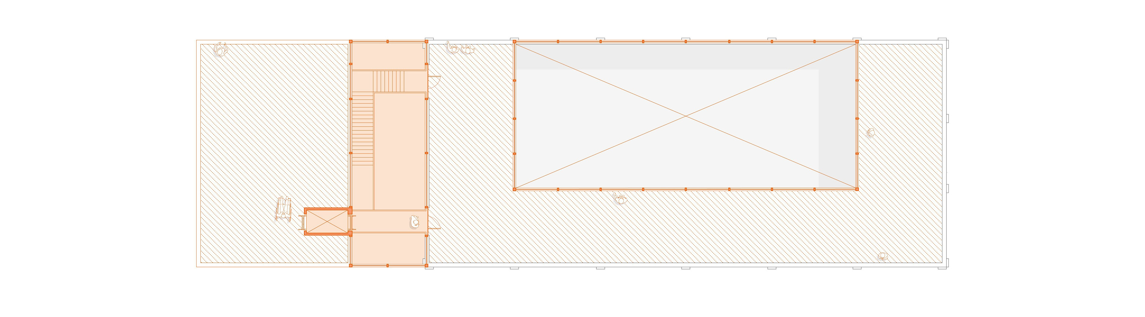
DPS 10: Level RF
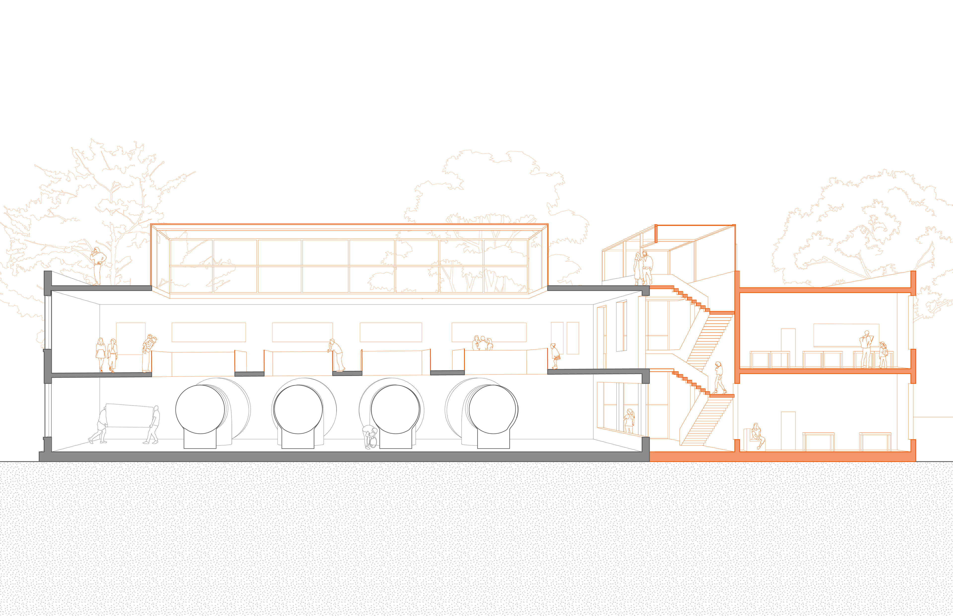
DPS 10: Section Perspective
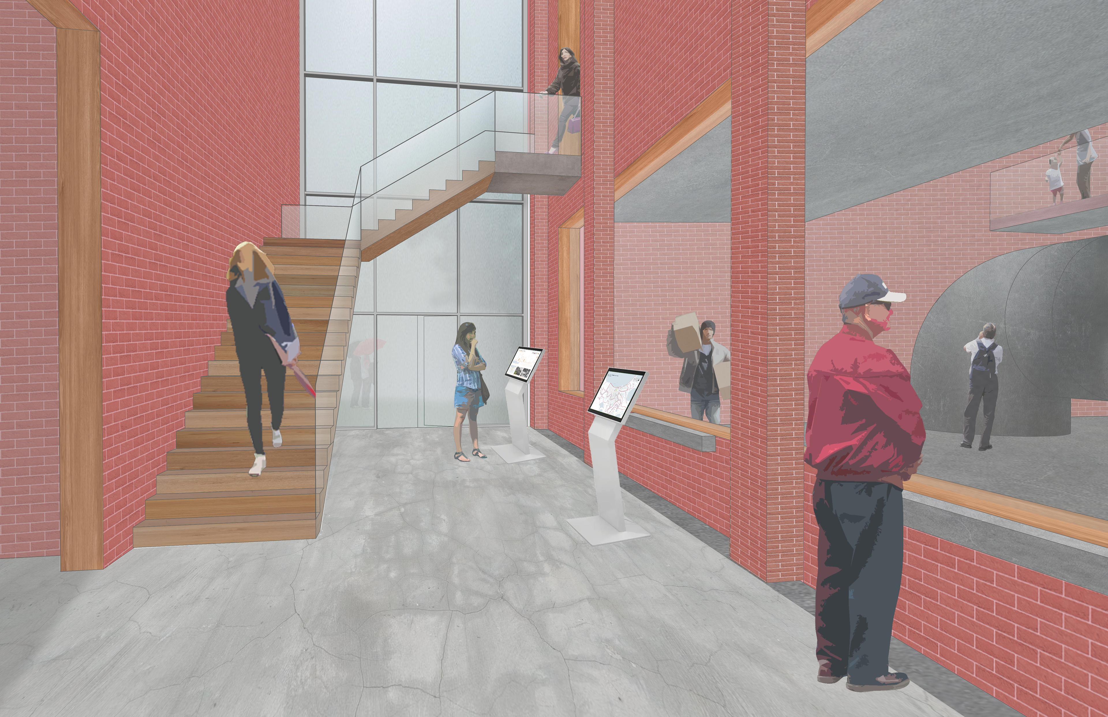
DPS 10: Entry Perspective
DPS 2: Lafitte Greenway Visitor & Volunteer Center
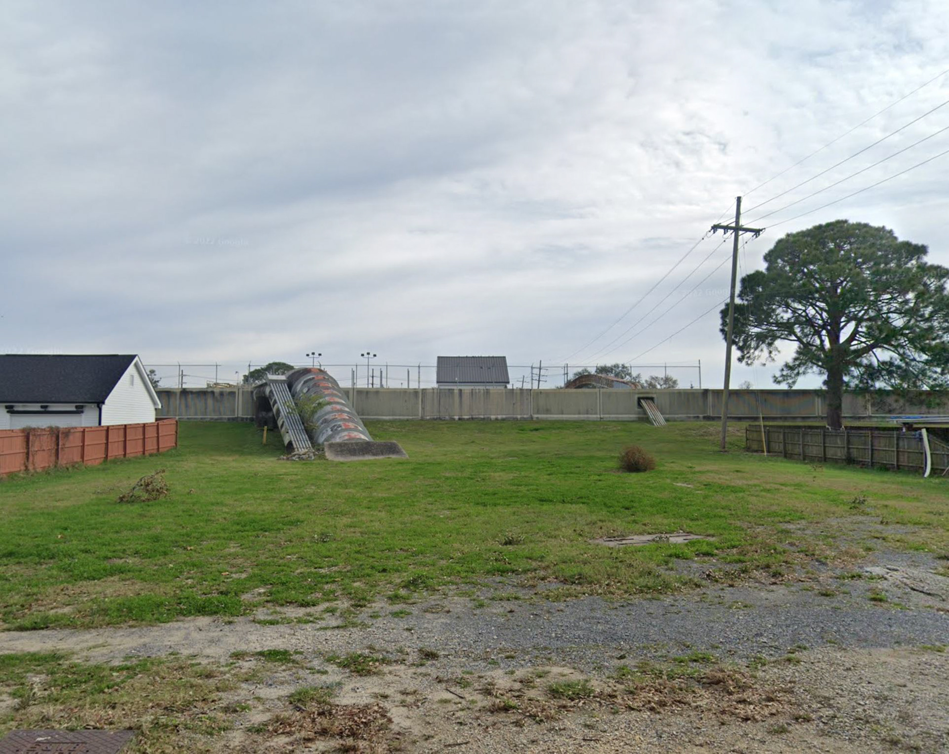
DPS 2: Existing Conditions

DPS 2: Site Axonometric

DPS 2: Site Plan
DPS 4: Community Bridge & Garden
DPS 4: Existing Conditions
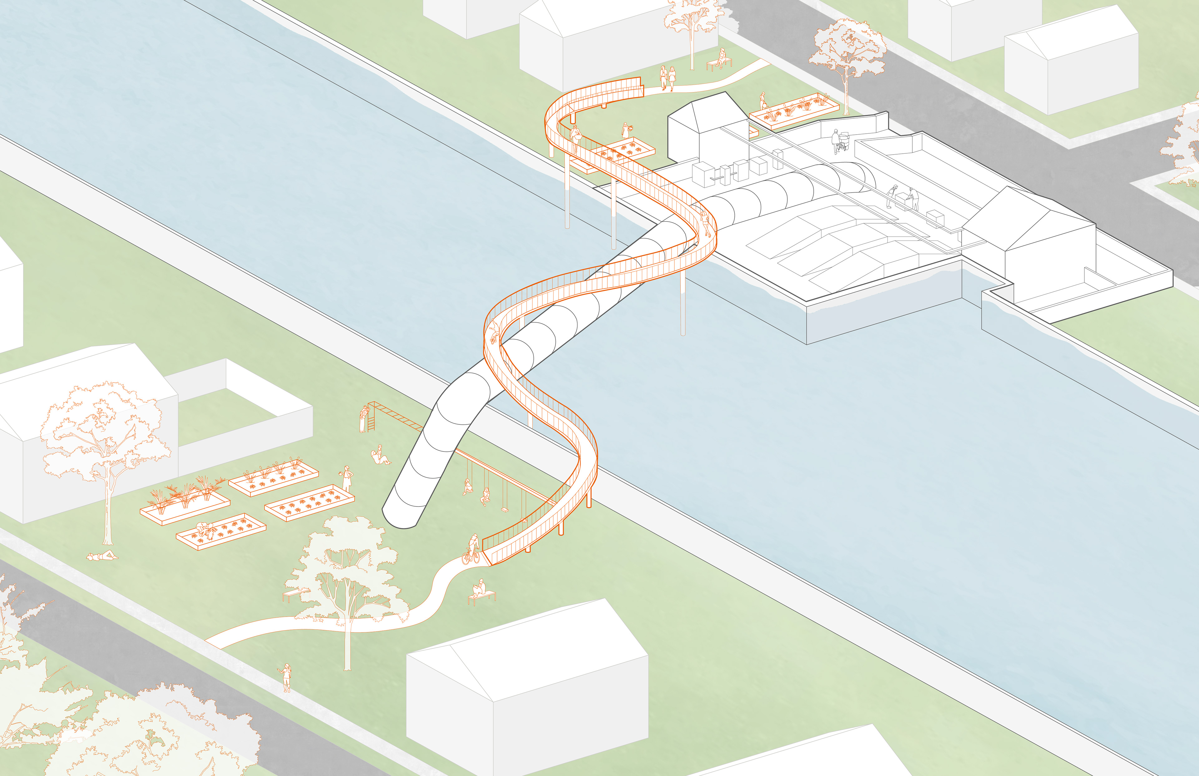
DPS 4: Site Axonometric

DPS 4: Site Plan
The design tactics behind these interventions can be extended across the city depending on the station’s appearance and the community’s needs. Potential programs include farmer’s markets, food halls, libraries, senior centers, blackbox theatres, and more. Communities should be involved in the design and programming of their neighborhood station.
These pump stations would be connected by new or upgraded paths that transform streets, canals, and levees into green-infrastructure alleys equipped with bioswales, bike-lanes, permeable pavement, and recreation. This system of pathways will not only foster practical water-management results, but also encourage connection between neighborhoods via educational bike or walking tours.
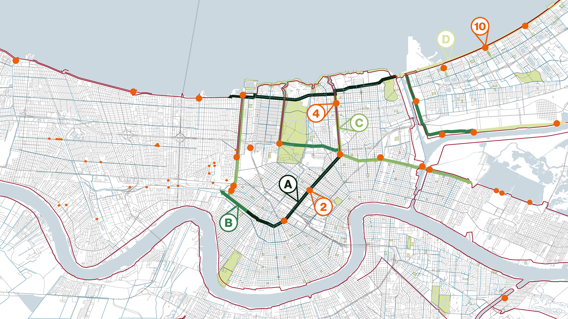
City-Wide Strategy: Pump Stations and Green-Infrastructure Alleys
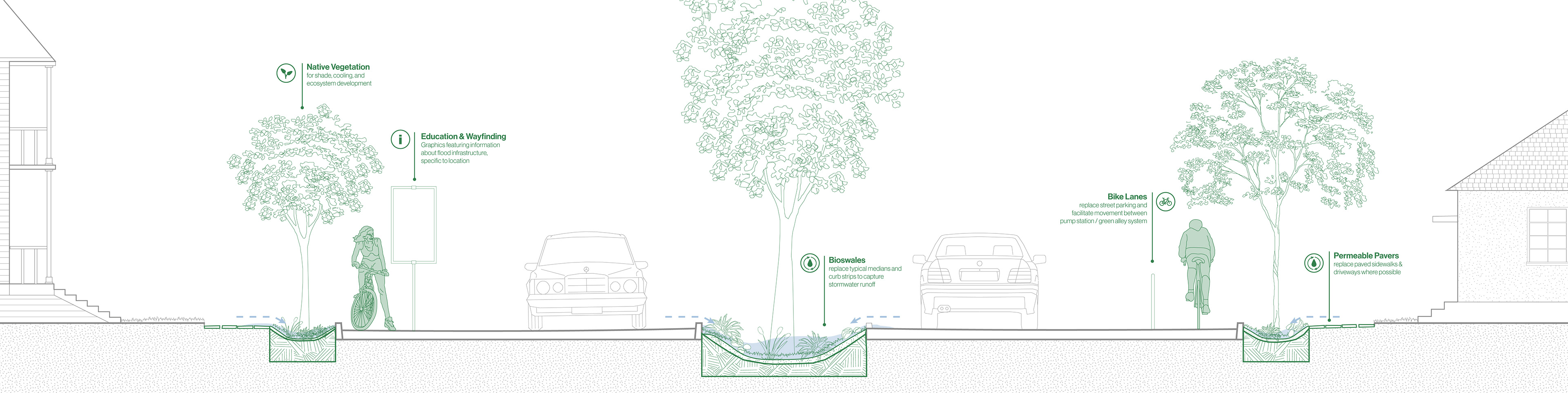
Strategy A: Paved Street, with median

Strategy B: Paved Street, no median

Strategy C: Canal Path
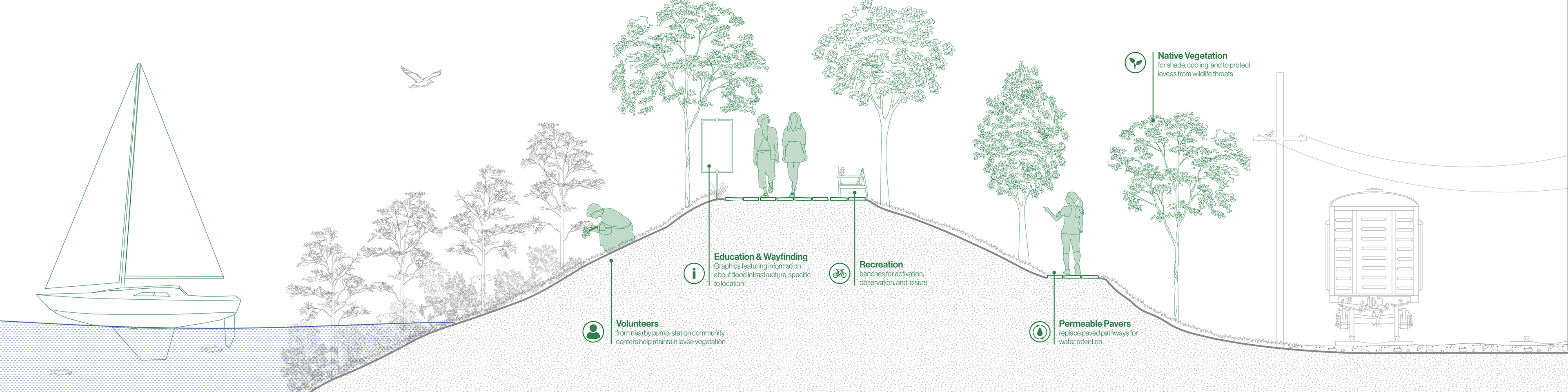
Strategy D: Levee Path