
Architecture, Infrastructure, and the City focused on the design of urban environments. We explored urban design as an integrative and pluralistic practice that draws from architecture, landscape architecture, and planning, and engages with the physical and social dimensions of the city beyond the limits of a single building, landscape, stakeholder interest, or design vision.
Through the study of a local place, we learned to detect, represent, and interpret patterns, episodes, and interrelationships in the urban environment across scales. Using the tools of urban design, we will test how interventions in built form, ecological networks, infrastructure, and public space productively engage with the intersecting challenges of the climate crisis and social injustice facing contemporary society.
As explained in the Analysis tab, the 14-acre site on Mission Hill is composed of parking lots owned by Wentworth Institute of Technology, newly built residential, and existing retail. Additionally, the site neighbors two Boston Public Housing developments: Mission Main and Alice Taylor. After a month of Site Analysis and Mapping, we reflected on our design values and used them to develop a written set of design principles.
These objectives, with an emphasis on the last two, served as the basis for the development of a physical urban design framework for the site, including building massing, program distribution, and mobility and open space networks.
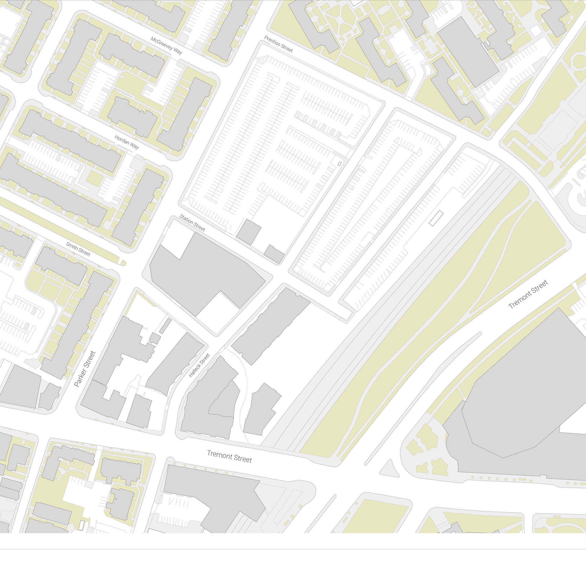
Existing Conditions
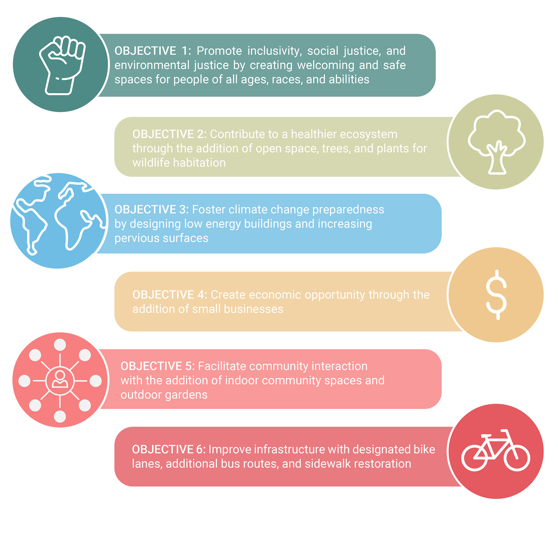
Design Objectives
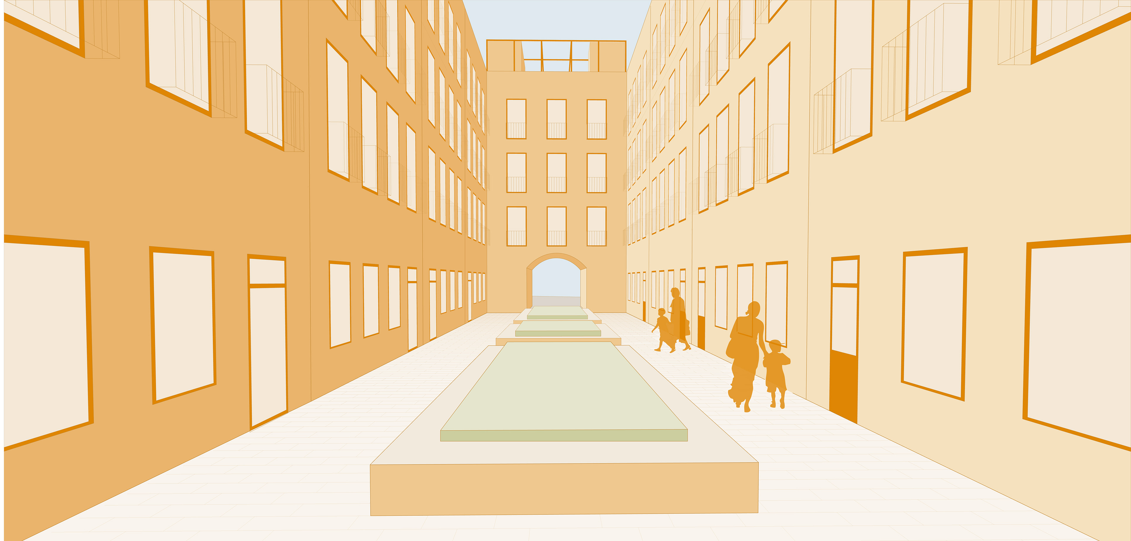
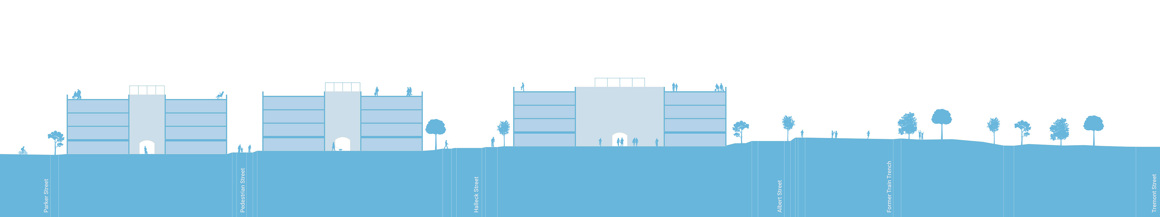
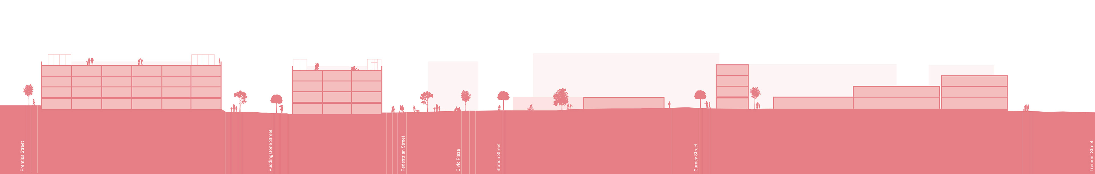
As evidenced below, the site is fraught with barriers and connectivity issues. The site's major barrier is the exposed train trench of the Southwest Corridor, which prevents connection to Tremont Street. My project's Urban Framework Plan demonstrates my strategy to enhance connectivity in three ways: decking over the train trench, improving vehicle streets with designated bike paths (marked in dark purple), and adding pedestrian-and-bike-only streets (shown in light purple) as an additional level of circulation.
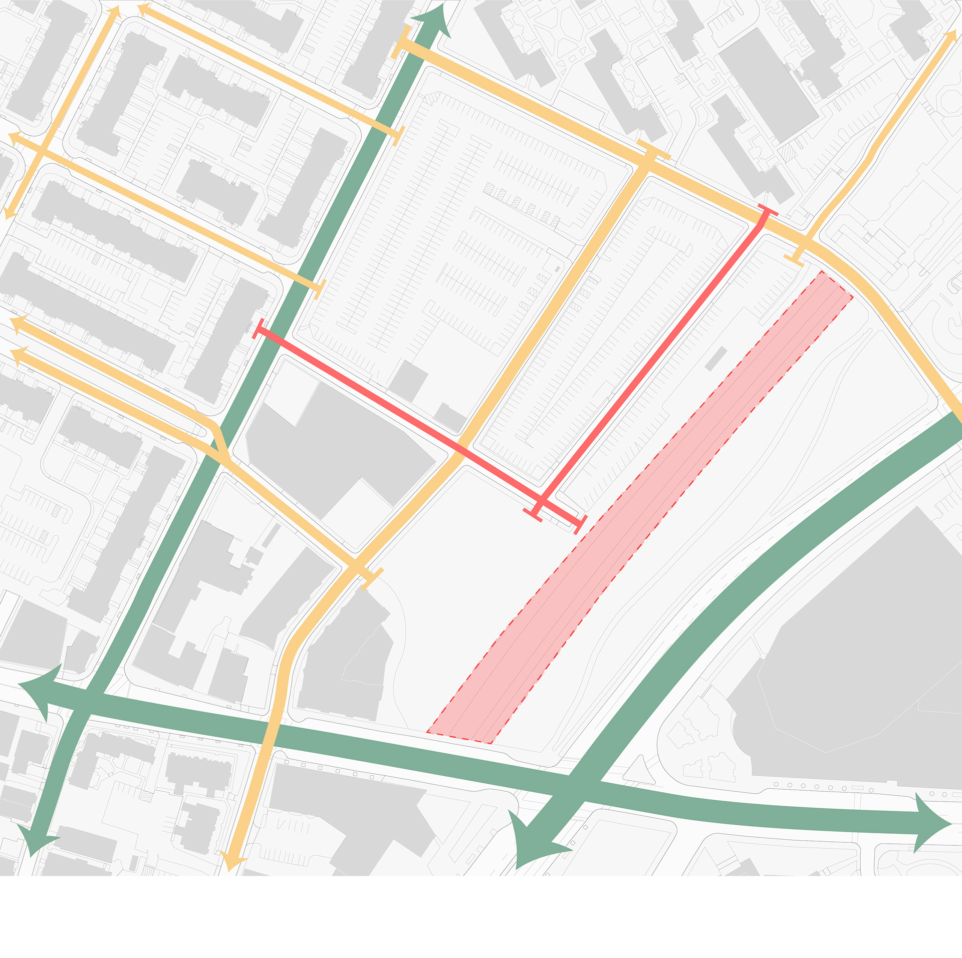
Existing Conditions: Connections and Barriers Diagram
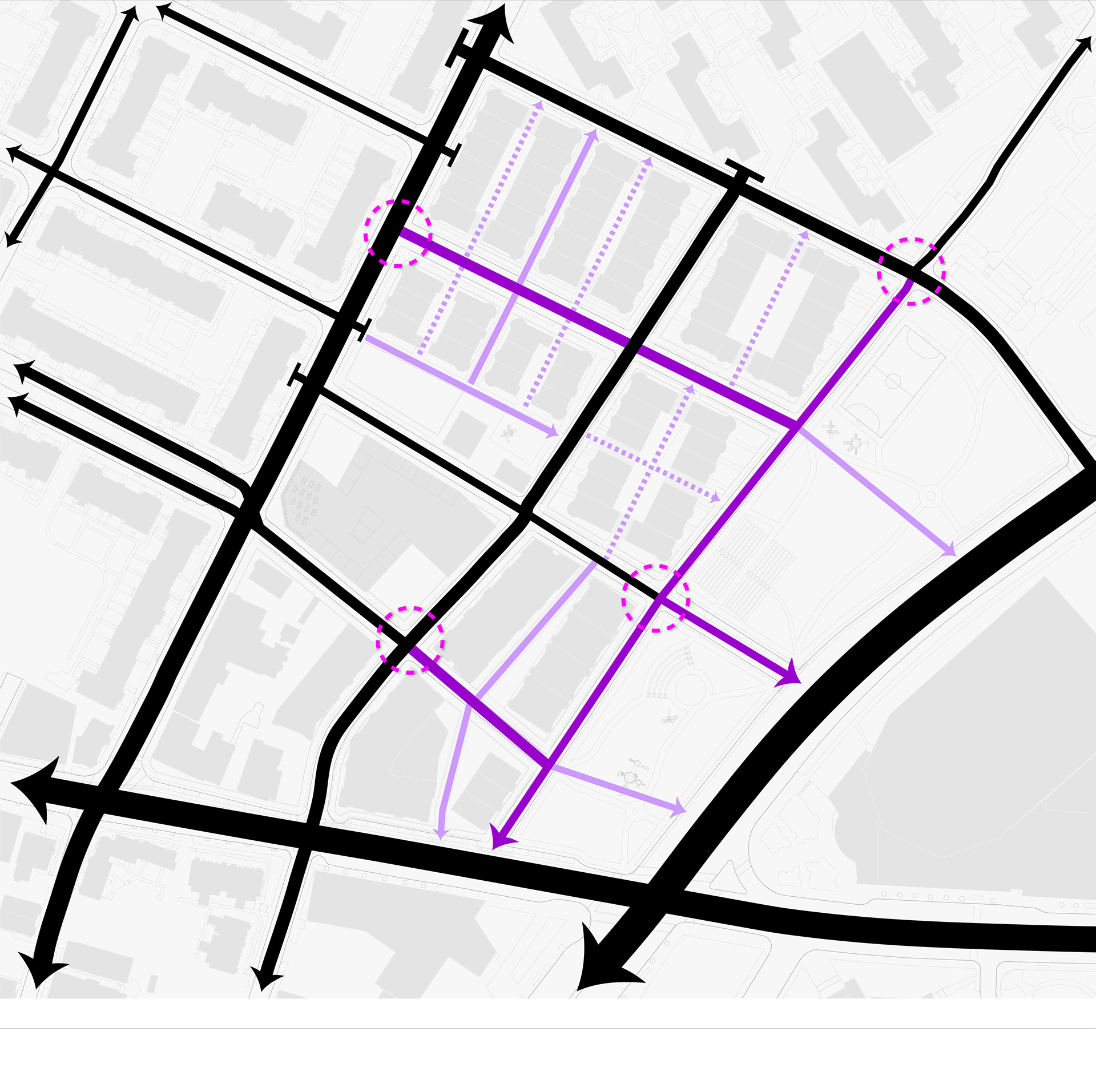
Urban Framework Plan: Improved Connections and Circulation
To determine the site's program, I examined the existing neighborhood amenities as well as the site's noise and circulation patterns. Tremont Street is the most heavily trafficked area as well as the neighborhood's commercial corridor. Parker Street is also quite heavily trafficked, especially by college students who travel it to get from their apartments on Mission Hill to their campuses.
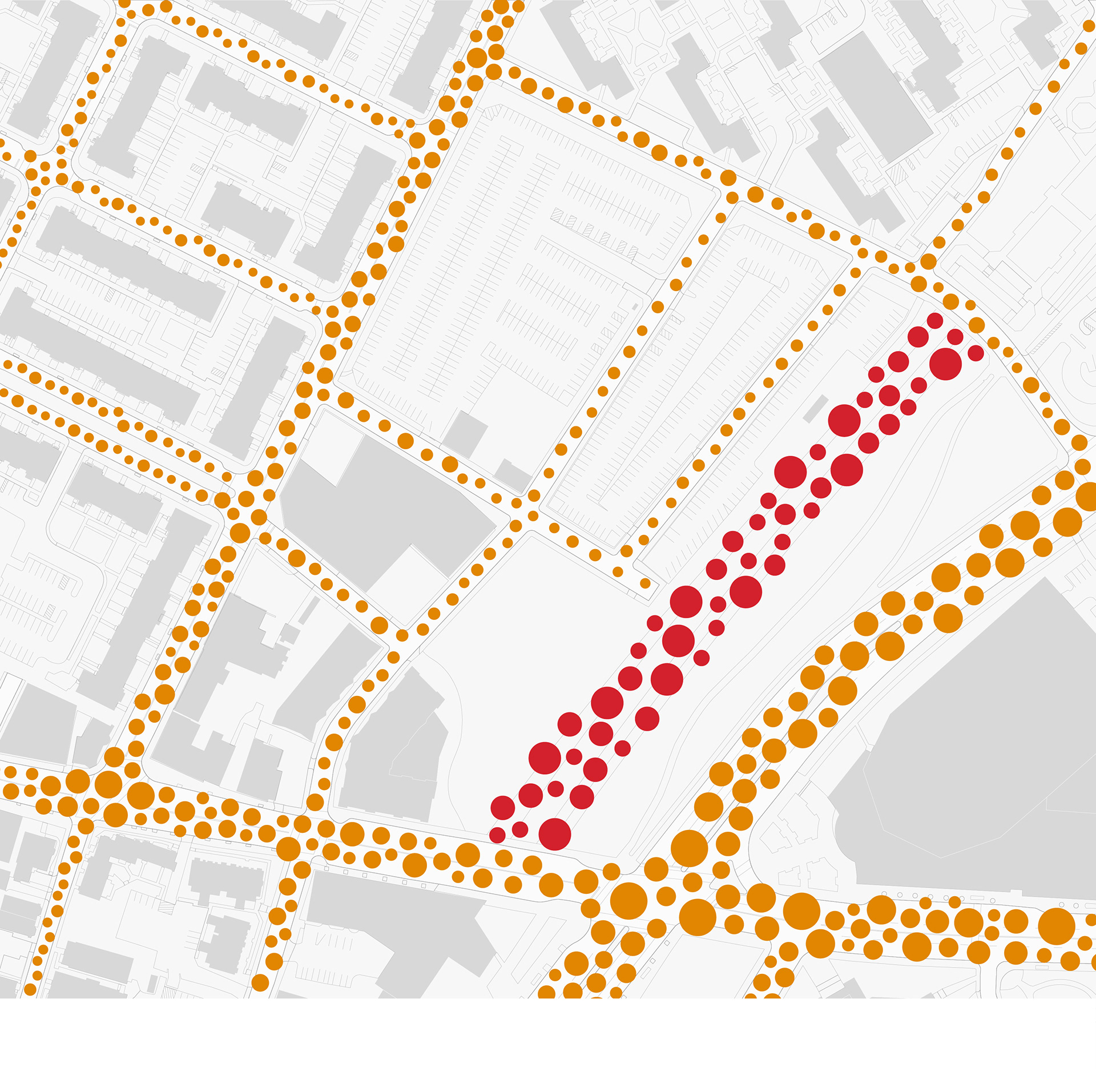
Existing Conditions: Noise and Circulation Diagram
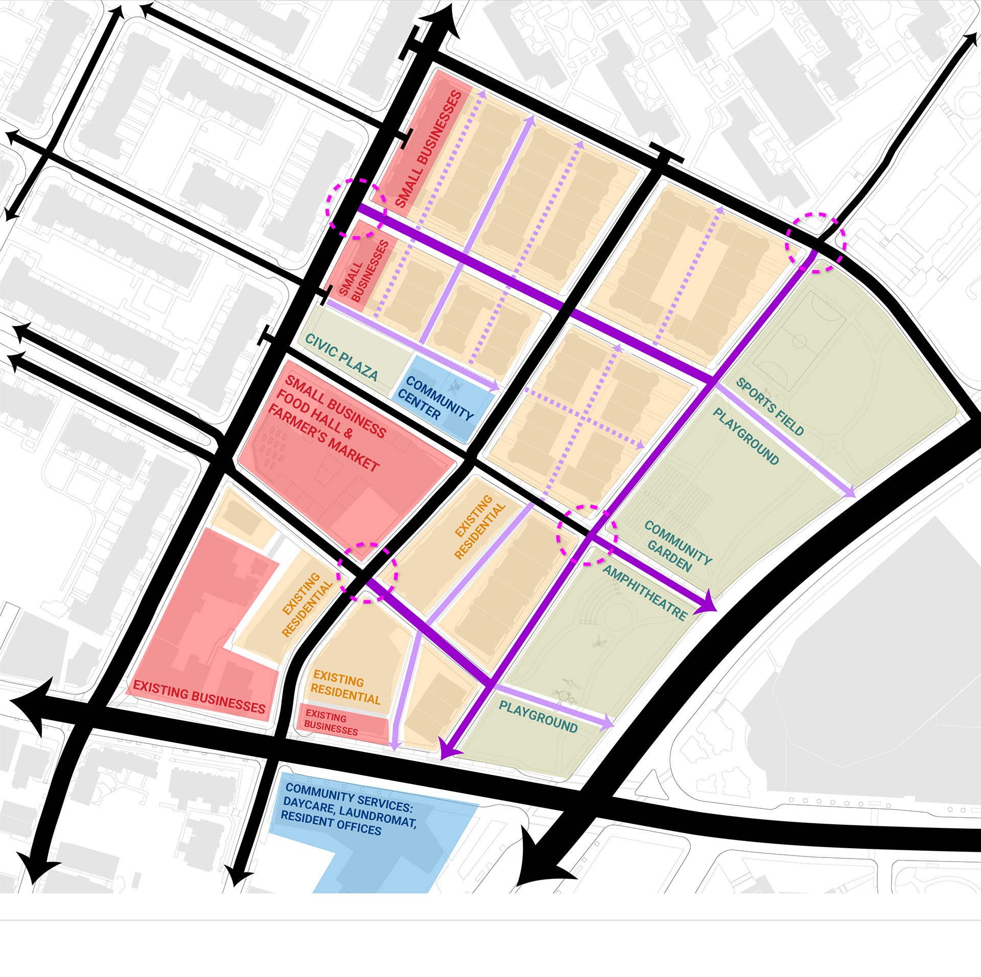
Urban Framework Plan: Program
My project seizes this activity as an opportunity to create a new commercial corridor along Parker Street in order to activate the site and invite users into the space. This corridor is anchored by a central square featuring a Small Business Food Hall (serviced by the site's community garden), a civic plaza, and a community center.
The remainder of the blocks are composed of Affordable Family Housing to help address Boston's affordable housing crisis. This housing takes the form of four-story Walk-Up apartments with shared community spaces on the first floor.
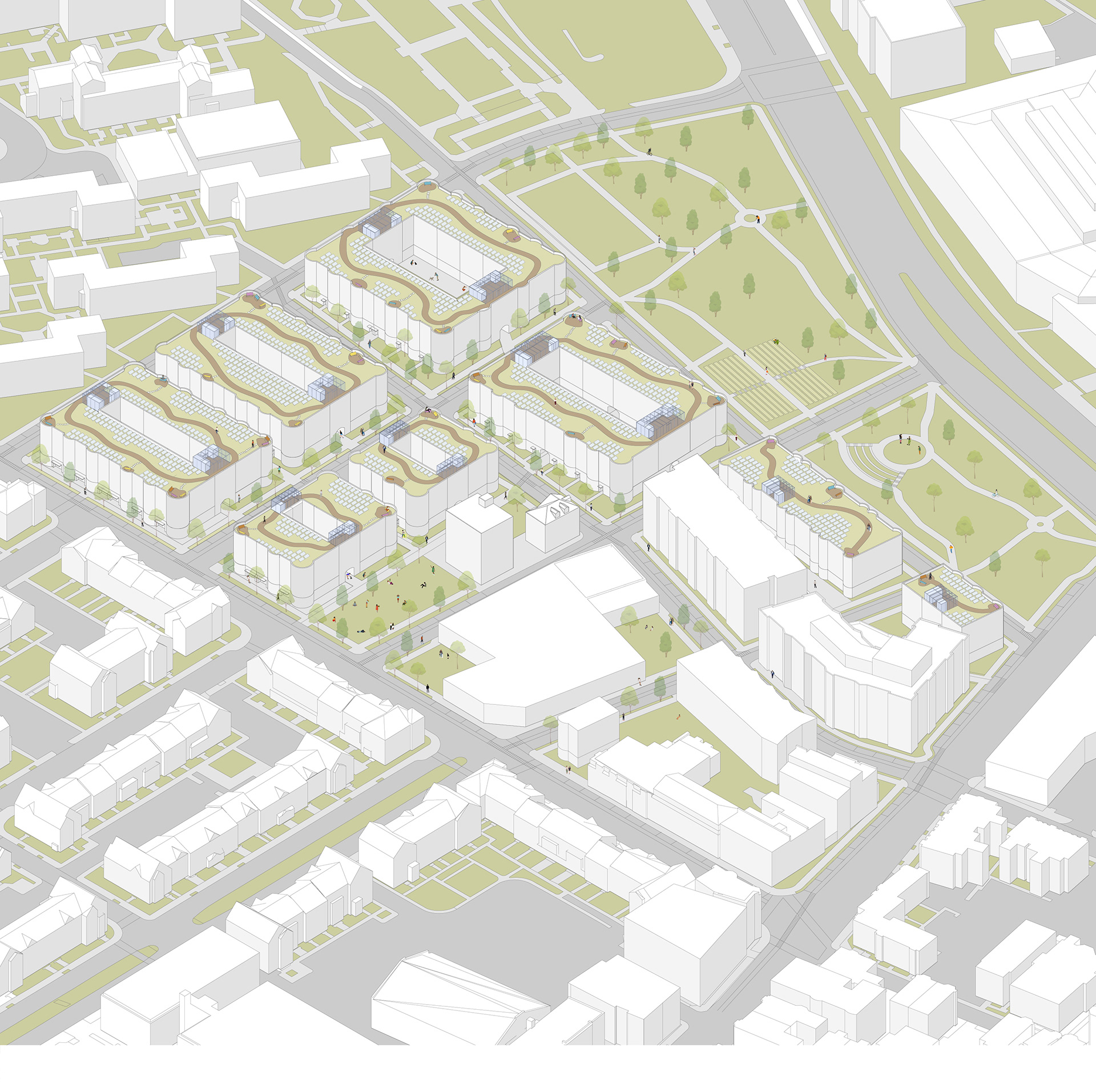
Illustrative Axon
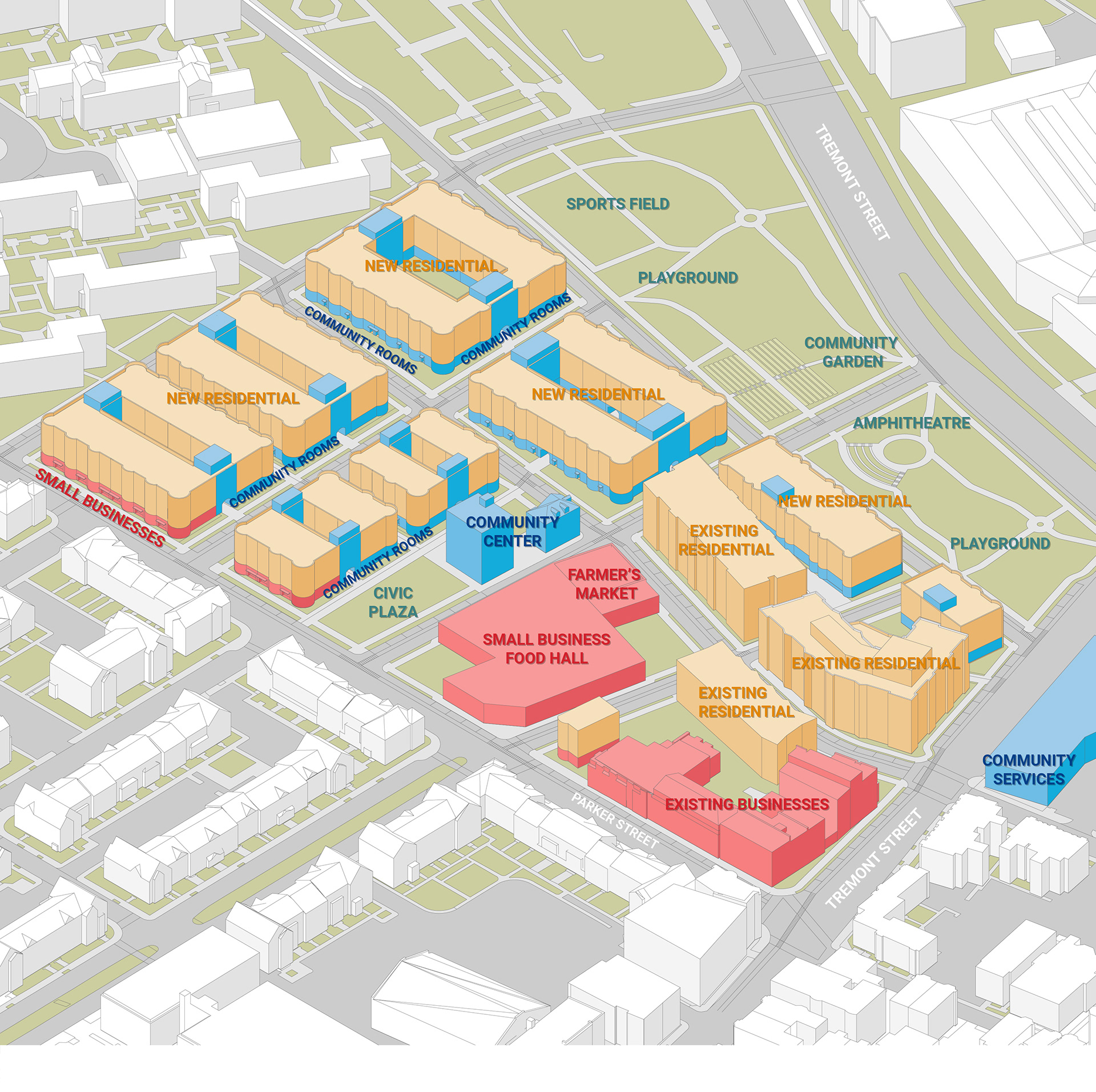
Program Diagram
The final phase of the project concerned Implementation and Urban Detailing, in which we focused in on a single block of our project. I zoomed in on the Northwest block in order to examine how the project would respond to the first-floor commercial program along Parker Street. We paired these Urban Realm Transects with Urban Design Guidelines.
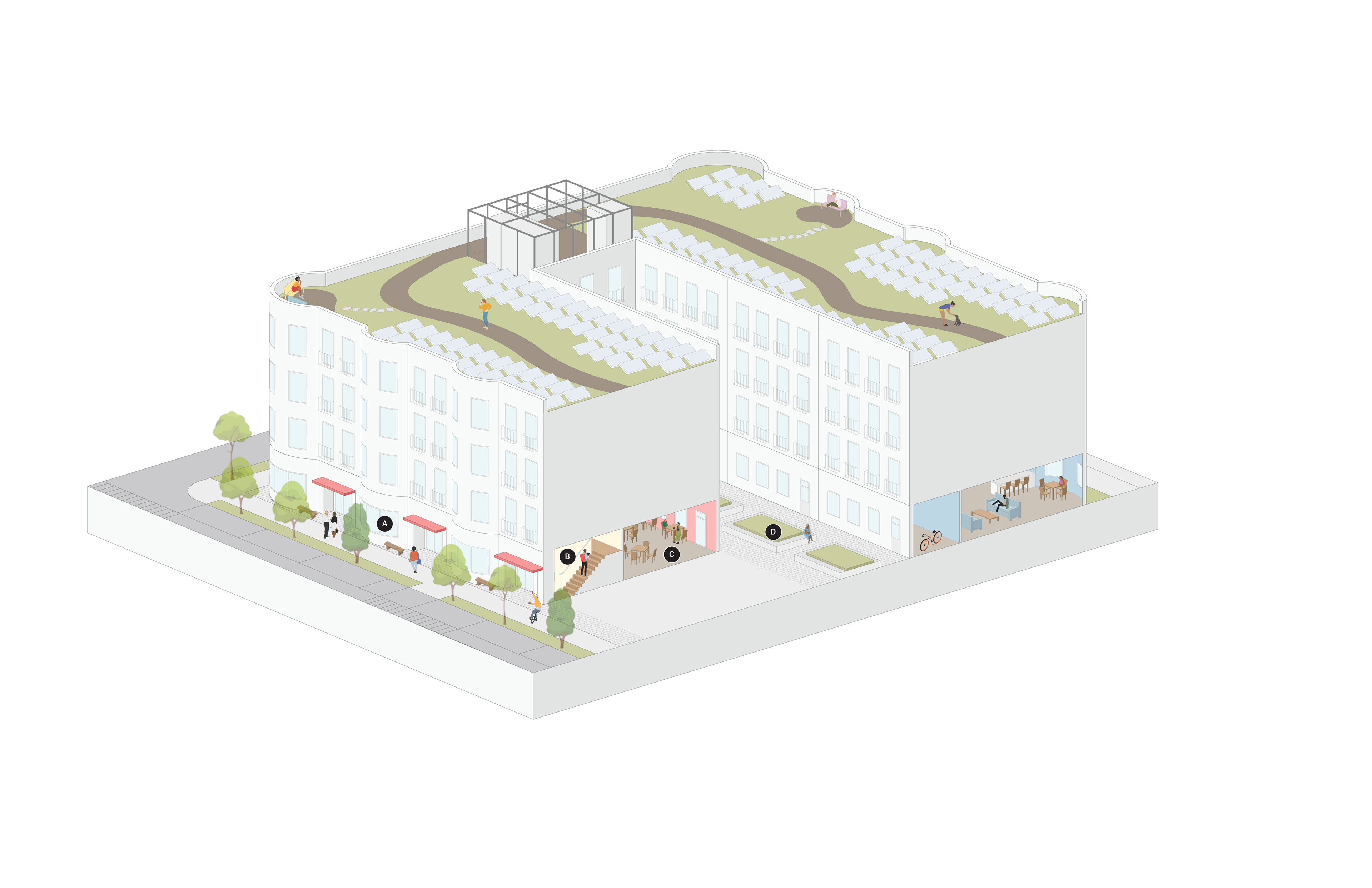
A: Entry Plaza
- Permitted at Commercial Entry
- Pervious pavement expands the sidewalk and public realm
- 8’ wide recessed entry, separate doors for Commercial and Residential
- Option for public seating when setback is large enough
- Permitted at Commercial Entry
- Pervious pavement expands the sidewalk and public realm
- 8’ wide recessed entry, separate doors for Commercial and Residential
- Option for public seating when setback is large enough
B: Residential Entry
Private staircase for residents of one walk-up building
Private staircase for residents of one walk-up building
C: Small Business
- Permitted along Parker Street
- May be occupied by Small Businesses including but not limited to cafes, restaurants, shopping
- Permitted along Parker Street
- May be occupied by Small Businesses including but not limited to cafes, restaurants, shopping
D: Courtyard
- Consists of central planting and seating
- Serves as back-of-house space for residents of one block including but not limited to bike parking, trash disposal
- Consists of central planting and seating
- Serves as back-of-house space for residents of one block including but not limited to bike parking, trash disposal
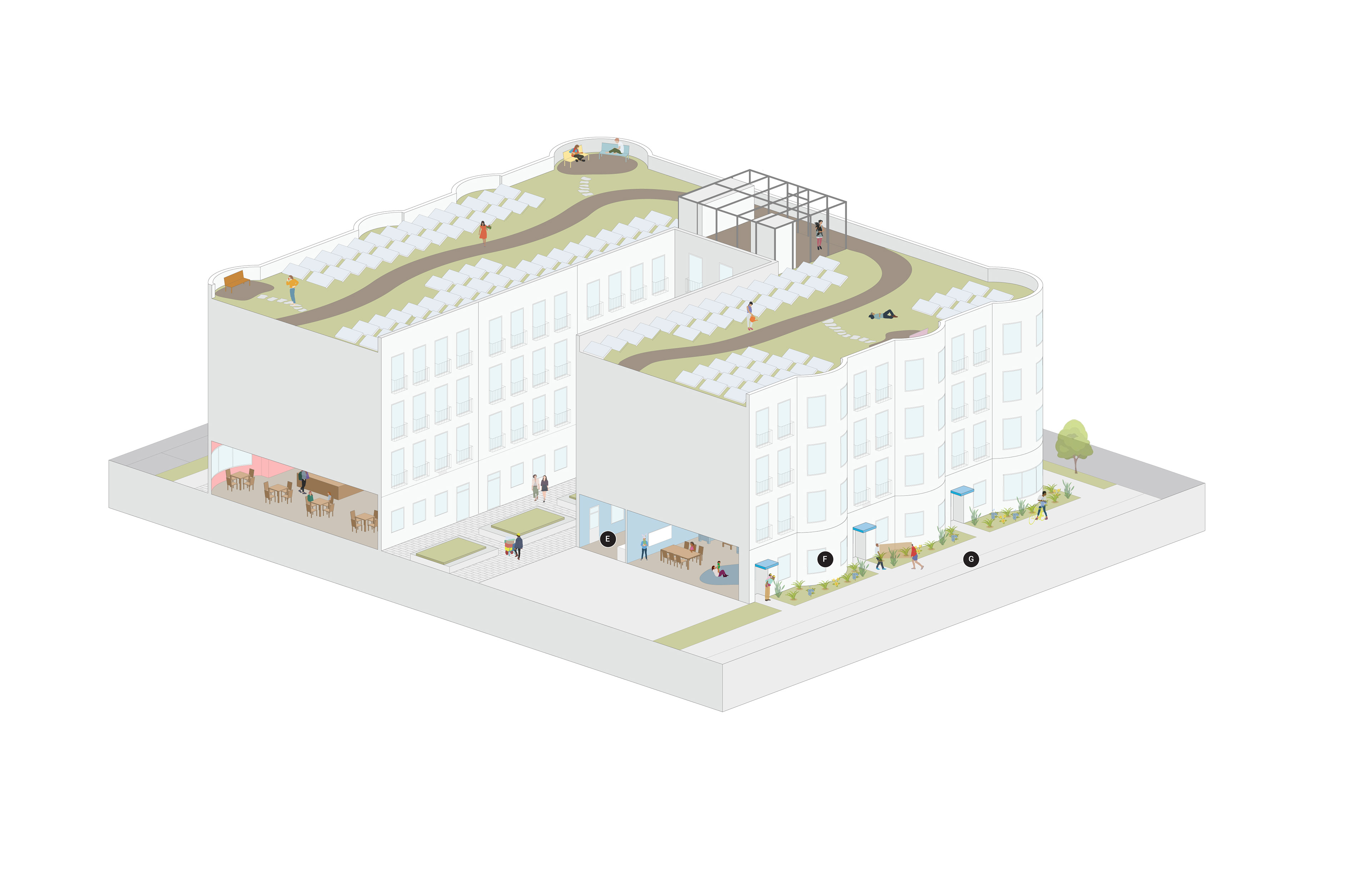
E: Community Room
- Permitted on ground floor of all walk-up buildings
- Programs including but not limited to bike parking, communal kitchen, work space, laundry
- Permitted on ground floor of all walk-up buildings
- Programs including but not limited to bike parking, communal kitchen, work space, laundry
F: Entry Garden
- Permitted at Community Entry
- Rain garden for water management and increased privacy
- Permitted at Community Entry
- Rain garden for water management and increased privacy
G: Pedestrian Street
- Located between residential blocks
- Accessible by pedestrians and bikes only
- Located between residential blocks
- Accessible by pedestrians and bikes only
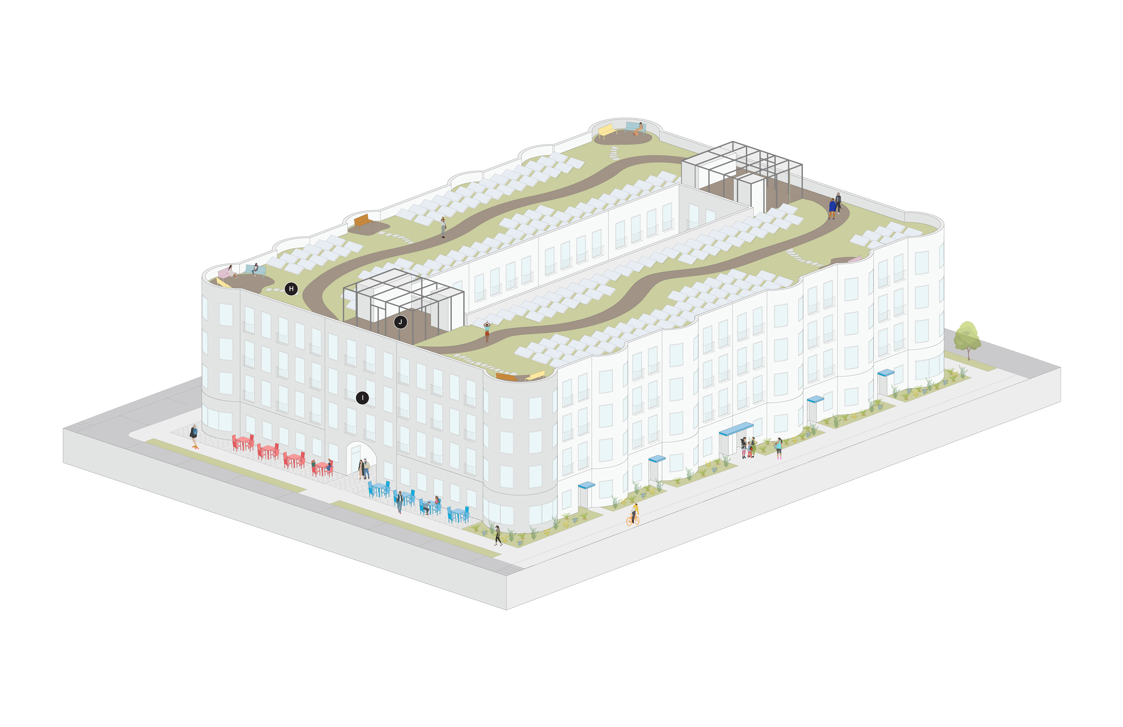
H: Biosolar Green Roof
- Native planting and solar panels for climate resilience
- Boardwalk pathways and seating areas
- Native planting and solar panels for climate resilience
- Boardwalk pathways and seating areas
I: Community Room Core
- Houses stair and elevator core for roof access
- Allows for corner units to be handicap accessible
- Houses stair and elevator core for roof access
- Allows for corner units to be handicap accessible
J: Greenhouse
- Provides additional space for community gardening
- Houses stair and elevator core for roof access
- Provides additional space for community gardening
- Houses stair and elevator core for roof access
Courtyard Perspective: The Orange Family heads off to work and school.
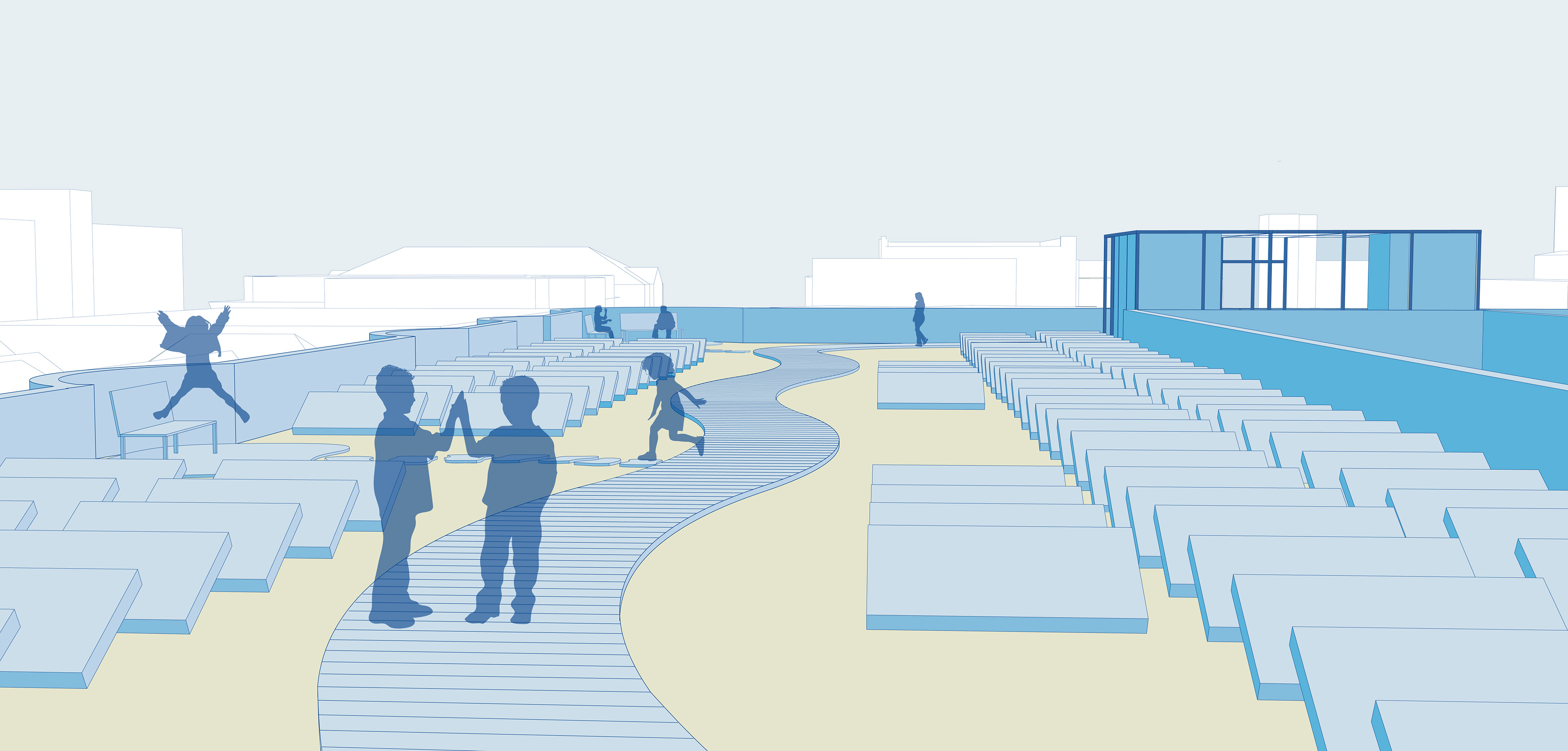
Roof Perspective: The Blue and Orange Families decompress on the roof after a busy day of work and school.
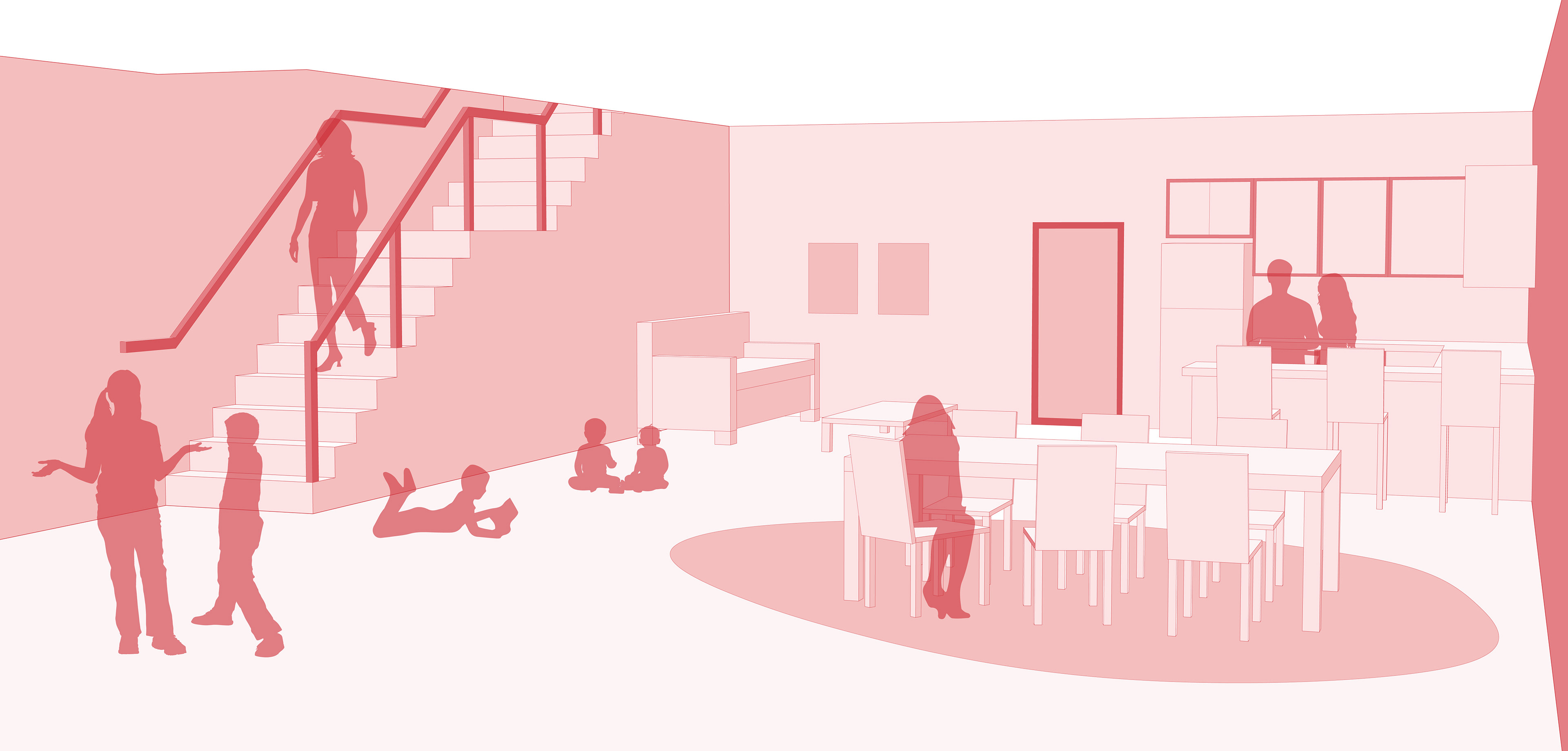
Community Room Perspective: The Red, Blue, and Orange Families gather in their communal living room for dinner.
Section: East-West
Section: North-South